Founded in 1971 >
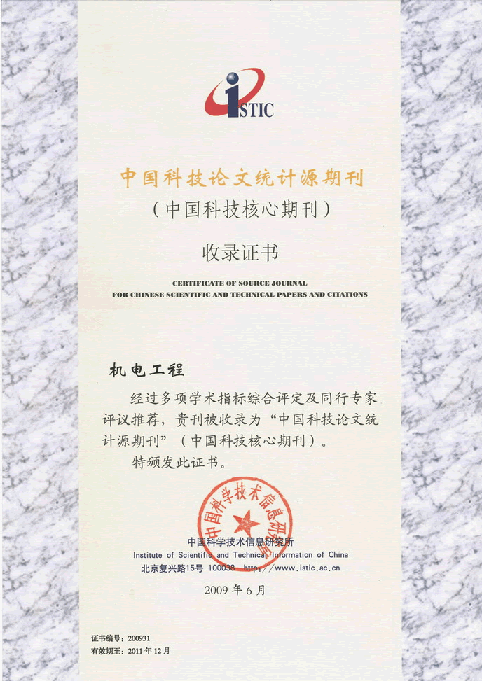
Chinese Sci-tech Core Periodicals >
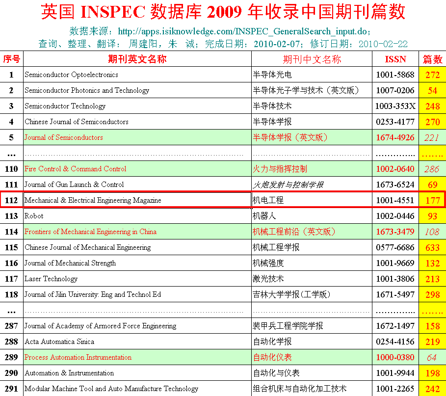
British Science Abstracts (SA, INSPEC) Indexed Journals >
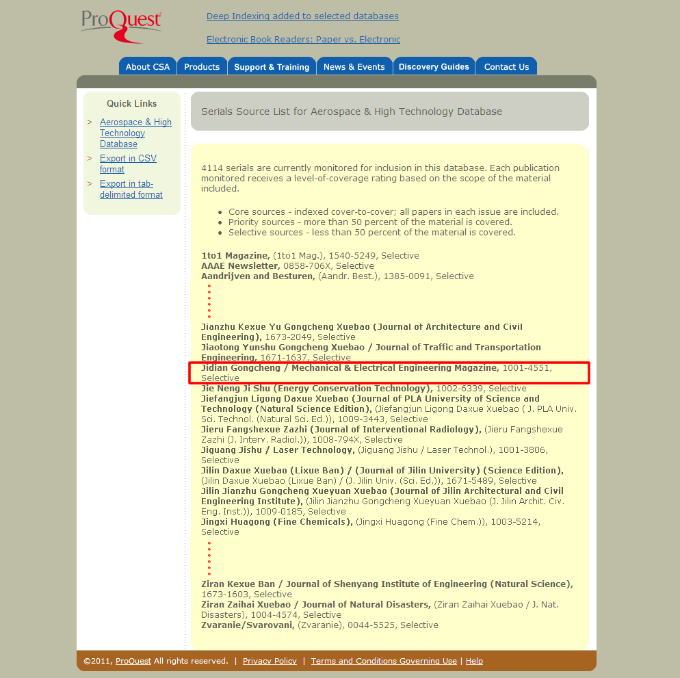
United States, Cambridge Scientific Abstract: Technology (CSA: T) Indexed Journals >
United States, Ulrich's Periodicals Directory(UPD)Indexed Journals >
United States, Cambridge Scientific Abstract: Natural Science (CSA: NS) Indexed Journals >
Poland ,Index of Copernicus(IC) Indexed Journals >
International Standard Serial Number:
ISSN 1001-4551
Sponsor:
Zhejiang University;
Zhejiang Machinery and Electrical Group
Edited by:
Editorial of Journal of Mechanical & Electrical Engineering
Chief Editor:
ZHAO Qun
Vice Chief Editor:
TANG ren-zhong,
LUO Xiang-yang
Tel:
86-571-87041360,87239525
Fax:
86-571-87239571
Add:
No.9 Gaoguannong,Daxue Road,Hangzhou,China
P.C:
310009
E-mail:
meem_contribute@163.com
Key words:three-dimensional simulation;Zhoushan area;flow field analysis


-
- Chinese Core Periodicals
-
- Chinese Sci-tech Core Periodicals
-
- SA, INSPEC Indexed
-
- CSA: T Indexed
-
- UPD:Indexed
-


Copyright 2010 Zhejiang Information Institute of Mechinery Industry All Rights Reserved
Technical Support:Hangzhou Bory science and technology