Founded in 1971 >
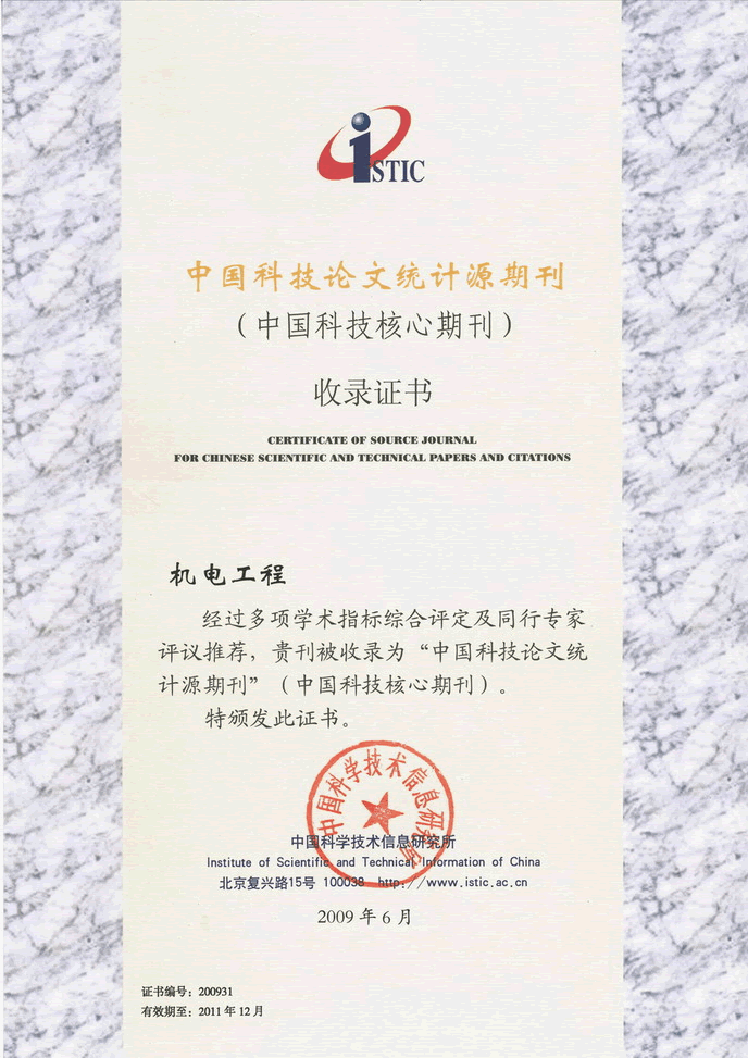
Chinese Sci-tech Core Periodicals >
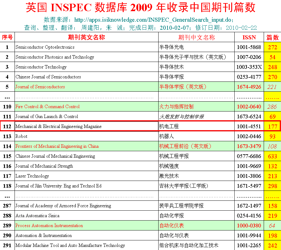
British Science Abstracts (SA, INSPEC) Indexed Journals >
United States, Cambridge Scientific Abstract: Technology (CSA: T) Indexed Journals >
United States, Ulrich's Periodicals Directory(UPD)Indexed Journals >
United States, Cambridge Scientific Abstract: Natural Science (CSA: NS) Indexed Journals >
Poland ,Index of Copernicus(IC) Indexed Journals >
International Standard Serial Number:
ISSN 1001-4551
Sponsor:
Zhejiang University;
Zhejiang Machinery and Electrical Group
Edited by:
Editorial of Journal of Mechanical & Electrical Engineering
Chief Editor:
ZHAO Qun
Vice Chief Editor:
TANG ren-zhong,
LUO Xiang-yang
Tel:
86-571-87041360,87239525
Fax:
86-571-87239571
Add:
No.9 Gaoguannong,Daxue Road,Hangzhou,China
P.C:
310009
E-mail:
meem_contribute@163.com
ZHANG Jie, ZHOU Jun
(School of Mechanical and Electrical Engineering, Hohai University, Changzhou 213022, China)
Abstract: Aiming at the mobile robot mapping problem that in the unknown environment, the information provided by the laser map is poor meanwhile vision slam has bad robustness, the combination of vision and laser mapping was studied, which the laser map was used for navigation and vision was used for reconstruct the scene. First, to process lidar data, regional segmentation and feature extraction was used. Regional segmentation was mainly used for the classification and recognition of feature patterns, and feature extraction was mainly used to determine the parameters of all kinds of features and the extraction of feature points. The improved ICP iterative nearest point algorithm based on RGBD frame was used to obtain the transformation relationship,and then the point cloud can be connected. The graph optimization algorithm was used to eliminate the cumulative error, to enhance the accuracy of the overall visual map. Based on the relationship between the lidar and the Kinect camera, the correspondence between the point cloud and the lidar coordinate system can be calculated, so that the fusion of the laser map and the point cloud map was realized. The results indicate that such method can realize the realtime establishment of the twodimensional map of the surrounding environment, and integrate the 3D point cloud information into the laser radar coordinate system. The method has high precision and good robustness.
Key words: robot; lidar; pointcloud; graph optimization; mapping


-
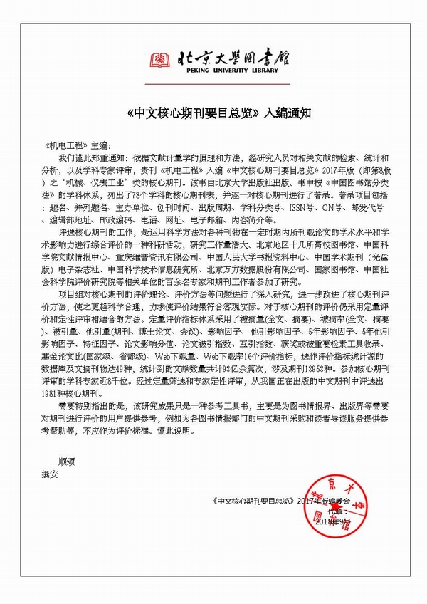
- Chinese Core Periodicals
-

- Chinese Sci-tech Core Periodicals
-

- SA, INSPEC Indexed
-

- CSA: T Indexed
-

- UPD:Indexed
-


2010 Zhejiang Information Institute of Mechinery Industry
Technical Support:Hangzhou Bory science and technology